


la fouillouse

fontvieille
User
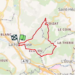

Length
12.8 km

Max alt
563 m

Uphill gradient
298 m
Km-Effort
16.7 km

Min alt
412 m

Downhill gradient
298 m
Boucle
Yes
Creation date :
2015-06-05 00:00:00.0
Updated on :
2015-06-05 00:00:00.0
3h32
Difficulty : Easy

FREE GPS app for hiking
 SityTrail
IGN / Geographical institutes
SityTrail Plus
The world is yours!
About
Trail Walking of 12.8 km to be discovered at Auvergne-Rhône-Alpes, Loire, La Fouillouse. This trail is proposed by fontvieille.
Description
rando en paemrtie ombragée et bord de rivuere
Positioning
Country:
France
Region :
Auvergne-Rhône-Alpes
Department/Province :
Loire
Municipality :
La Fouillouse
Location:
Unknown
Start:(Dec)
Start:(UTM)
603011 ; 5039419 (31T) N.
Comments